Polar air mass brings snow and temperature drop in Iraq


Shafaq News/ Rain will persist across northern Iraq through Thursday before gradually subsiding on Friday, while snowfall is expected on Sunday, an Iraqi meteorologist said.
Meteorologist Ali Al-Jaber Al-Ziyadi told Shafaq News that the rain, which started today, will persist until evening and could be heavy in various northern regions, as well as in Diyala and Saladin. Other areas, including Baghdad and northeastern Wasit, will see scattered showers tonight, while rainfall weakens in the rest of the country.
He added, “Snowfall is expected early Sunday across most northern cities and parts of central Iraq, including Tikrit and western Anbar," warning that the snowfall could trigger a significant temperature drop. Daytime temperatures could fall below 14°C in central and southern Iraq, with even lower readings in western and northern areas. He also noted that rainfall is likely to return at the beginning of March.
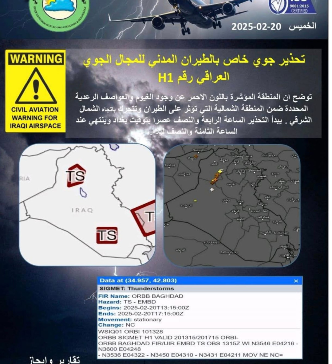
Iraq's General Authority for Meteorology and Seismological Monitoring issued a warning to aircraft regarding thunderstorm clouds over the next two hours.
The authority also explained that Iraq is experiencing a severe cold front due to the arrival of a polar air mass in the upper atmosphere. “This will bring scattered rain showers and snow on mountain peaks, with some lower-altitude areas also seeing snowfall. A sharp drop in surface temperatures is expected, marking the coldest spell of the winter season, with freezing conditions likely in the morning and night hours.”
“The cold front will persist until the middle of next week, reaching its peak impact on Monday through Friday,” the authority stated.